Biggest Thermal Flight Anniversary, Soaring Spot Integration & Live Tracking Updates

Hey everyone, The season is in full swing! Miles and badges are dropping like crazy, and we're constantly working to improve the platform. We hope you get your share of flying this season and make some unforgettable memories.
📮 Do you have friends and colleagues who also want to get cozy on the couch with the latest news from the world of gliding? If you enjoy this newsletter, feel free to use the following link to share it with your friends or on social media:
🔗 https://magazine.weglide.org/weglide-season-updates-live-tracking-soaring-spot/
We would really appreciate it. 🙏 But now, let's get to the latest news from WeGlide! ⬇️
Anniversary of the Biggest Thermal Flight on WeGlide
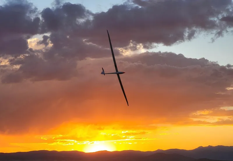
Well, almost. There is a slightly longer thermal out flight by the Australian pilot David Jansen. But when it comes to closed ones, two years ago today, New Zealander Keith Essex accomplished something extraordinary. Flying purely on thermals, he soared over 1,500 km across the American Wild West in his EB29R. After just over nine hours, Keith touched down on the tarmac in Ely, Nevada, again. His average speed was an incredible 175 km/h 🚀 – still an unbelievable flight and a perfect example of what happens when one of the best pilots, in one of the best gliders, at one of the world's best locations (weather-wise) decides in the morning, "Today, I go gliding."
Live Tracking Updates
Whether you're following your friends' flights or cheering along during competitions with live scoring, Live Tracking is becoming more and more popular, and we have a few updates for you.
When you select multiple flights, not only are the flight paths overlaid, but the barograms are as well. This makes it even easier to compare and analyze different flights.
A lot of work has also gone into our Day Replay feature, and we're very happy with the result. The replay function now runs smoothly. Especially beautiful to look at in combination with the sat images for a competition.
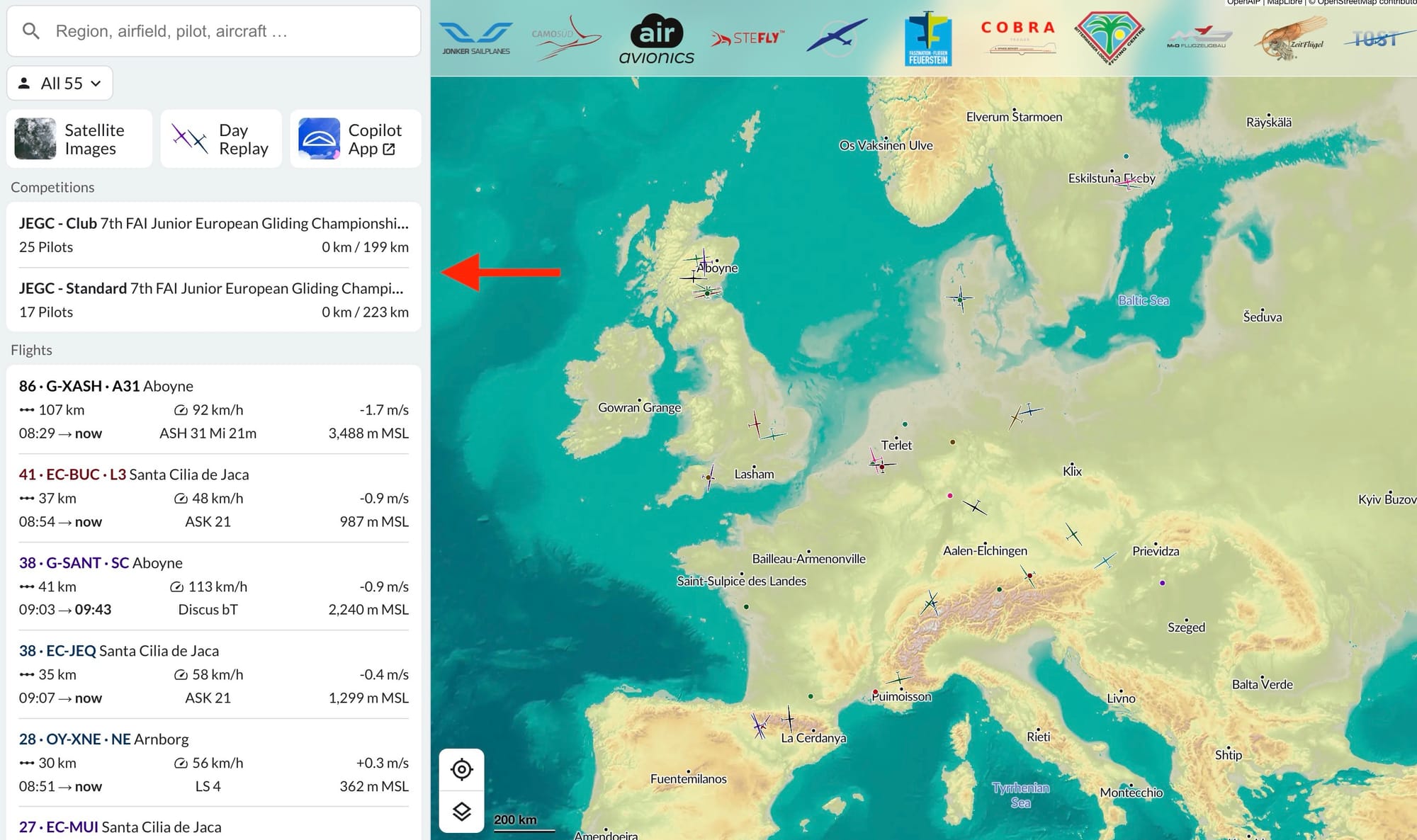
Speaking of competitions, they are getting more visibility. Right below the satellite images, you'll now find currently active competitions that you can follow live on WeGlide. With our integrated live scoring, you'll have a good idea of who might win the day long before the official SoaringSpot results are published.
By the way, we're constantly working on optimizing processes behind the scenes to make your WeGlide experience even better.
For example, we've improved the image upload process. Images are now compressed before being uploaded (instead of uploading in full quality and then compressing). This results in a 10x faster story upload after your flying day.
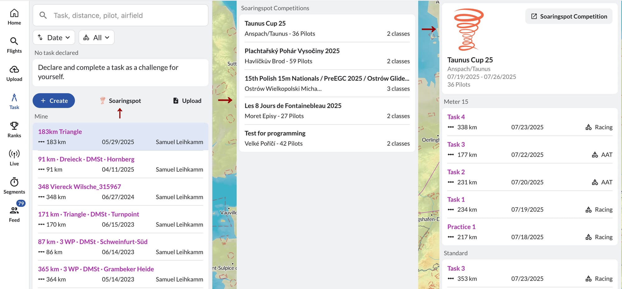
SoaringSpot Integration
Are you a competition pilot? Then we have great news for you. It's finally possible to load the daily task into WeGlide. You can find it in the Task Planner by clicking the SoaringSpot icon (top left in the screenshot). All current competitions will be displayed. You can select your competition and class, and the official task will be loaded directly into the WeGlide Task Planner.
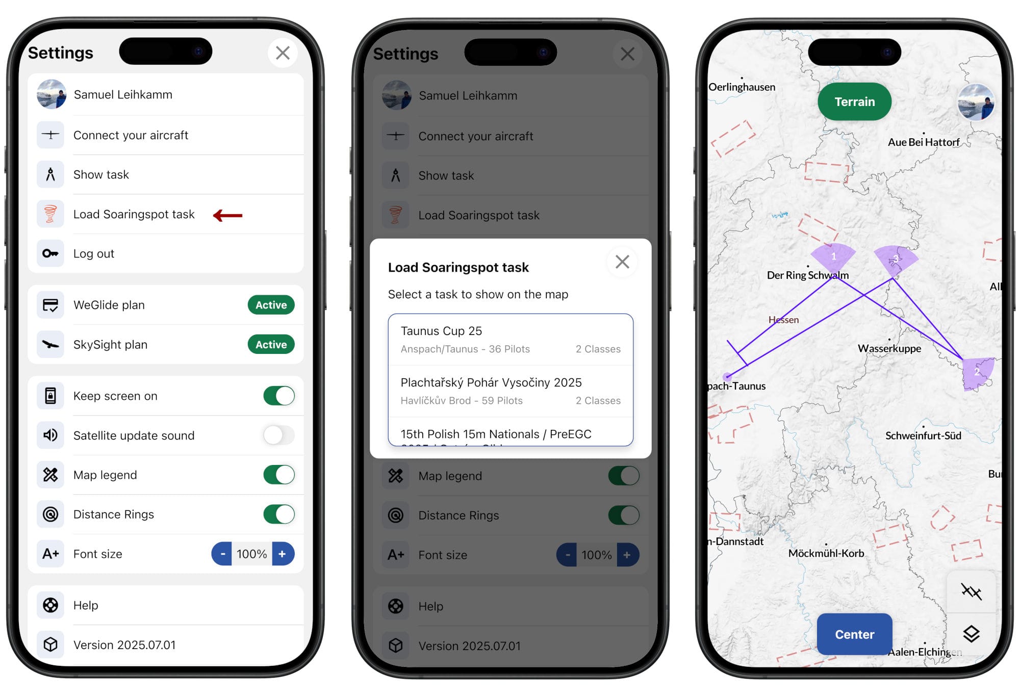
SoaringSpot is also now integrated into our Copilot App. Go to your profile (top right), click Load SoaringSpot Task, select your competition, class, and the daily task, and your setup for the day is complete.
The New Potential of Live Satellite Images
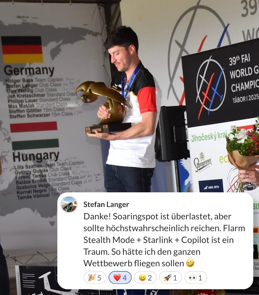
For many pilots, our live data app is gradually becoming a standard piece of cockpit equipment. We're noticing this isn't just the case for competition flying—though we were thrilled to see Stefan's comment under his winning flight at the Club Class World Championships in Tabor 😇 Congratulations again, Stefan!
Our team especially enjoys using Copilot for recreational flying, away from the hustle and bustle of competitions. What do you need for the Copilot?
- A good internet connection for your smartphone. ✅
- A stable mount that positions the phone above the canopy frame (this is also good for reception, as smartphones are often sensitive to being moved around too much in the cockpit). ✅
- A decent day with enough gliders in the air to provide data. ✅
In the beginning, we also wondered how to best handle the new flood of data in the cockpit. Over time, however, some exciting routines have developed. To put it simply: the way we use live assistance hasn't changed much—it has just become much, much better!
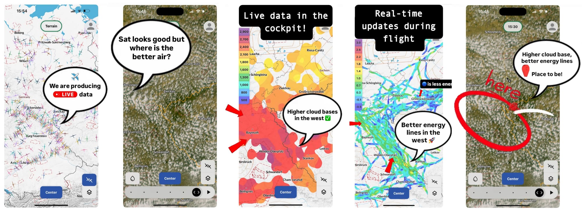
We're sure there are many best practices to discover, but today we want to focus on using satellite images. Our team has always loved flying with live satellite imagery. It's an excellent tool for optimizing your flight path and has definitely led to a leap in cross-country performance in recent years. But what if the satellite image is covered with uniform clouds? Where is the best energy?
With Live Cloudbase and Live Net-Lift — both generated by other gliders acting as "data buoys" in the air—a quick glance is now all it takes to interpret the satellite image even better! Check out the example in the photos below and see for yourself!
Social Media Overlay
As you probably know from other platforms, you can now quickly and easily showcase your flight on social media. For example, in your WhatsApp status or an Instagram story. Just pick a picture you've uploaded to your WeGlide story, click on it, and hit the "share" icon in the top left. You can then choose where to share your overlay. Now, it's easy for your non-flying friends to understand what you accomplished in your glider today.
Thanks for your time and attention ❤️