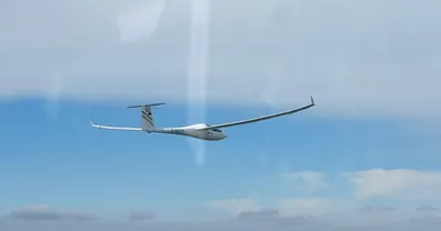
1400km of Thermal Gliding | Alexander Müller
Story
We meet Alexander a few days after his historic flight. During the conversation, he conveys the serenity of a person who has experienced so much that nothing can shake him. But if you listen more closely, you can still tell that the events of July 5th and the media response that followed did not leave him untouched.
Alexander, first of all, congratulations from the entire WeGlide team, an amazing achievement!
Thank you very much, it was a great, eventful flight. The night before, together with the Late Night Soaring Team, I recorded the "Flight of the Month June" episode, which was broadcast on July 7th, i.e. after the 1,400 km. I did not expect that the opportunity to top my 1,300 km flight in June arose so quickly.
There are now around 13,000 gliding hours in your flight log. You did many of these in Namibia. Despite your packed adventures, will the 1,400 km flight on July 5th stick to your memory?
In Namibia and South Africa? Maybe 2,000-3,000 hours? I didn't count them. I have to admit that many great flights are forgotten in their entirety. Some pilots can reproduce their flights in detail years later. Unfortunately, I'm not one of them, but many individual highlights stick in my mind, which I already noticed during the flight: "You won't forget that anytime soon".
For example?
Especially, the strokes of luck that ultimately led to a great flight or a record. But of course, also tragic moments when really big flights fail due to some coincidence. The final thermal that you just got, as well as the lows just before the finish. Or situations that made extreme demands on me, stay in my memory!
And what about your biggest flight in Germany?
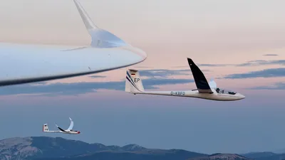
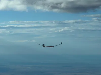
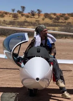
As I flew the 1400 km, it was probably the entire last hour. I will never forget them. At that time I even took two photos, which I finally uploaded to the flight story. I usually never take photos during my flights because I just don't have the capacity for it. But I had to capture this moment!
Oh, we believe that. Many people cheered for you in the live tracking!
Well, fame is not forever and that doesn't hurt me either. For me, it was just fascinating to have pushed the boundaries again. However, the fact that so many glider pilots were happy for me and the high response after uploading really overwhelmed me!
I only got to know the WeGlide Live functionality two weeks before this flight through my son. I am particularly fascinated by the new live scoring. On July 5th, I used it for the first time during the flight to see what the other gliders were doing, where they were going, how fast, and how many kilometers they had. Indeed a very motivating tool during the flight. In my opinion a real milestone!
In the comment section, you wrote among other things: "Now I can finally retire". What will motivate you in the future? Is it those days of extreme results, or do you still have the pure joy of gliding?
I was kidding! What really drives me has always remained the same during my numerous hours in the cockpit: the constant exploration of new possibilities, the fascination of constantly pushing the limits of gliding a little further, and making use of the experience I have gained. That's how I am, I've always been, and that's still what drives me. The fact that long distances result is actually in the nature of things.
Then let's talk about the day. You already discussed how you prepare your flights meteorologically in Late Night Soaring. But did you see the potential of the weather from the July 5 forecast?
In all honesty, I regarded the day as rather average. The evening before, my wife had the obligatory question: "Well, are you going to fly tomorrow?" to which I replied: "Well, I would "test" the weather".
The weather forecasts have become incredibly good nowadays and have increased the level of performance in gliding a lot. Nevertheless, these are still predictions and models. The actual quality of the weather can only be judged realistically while sitting in the cockpit. So if you have the time to use the flight day, you should always do so. On some days you will be disappointed, on others positively surprised!
At what point were you able to assess the potential of this day?
Well, my pre-flight routine is always the same. From eight o'clock I have the plane ready and I'm ready to take off. I then devote my attention exclusively to the nearby Fichtelgebirge. This always, I really mean always, develops first. As soon as the smallest piece of cloud forms there, I take off. By the time I actually shut off the engine above the Ochsenkopf, the second-highest mountain in the Fichtelgebirge, another ~15 minutes have passed. That's where a morning ritual begins for me.
Wait a minute, let's backtrack a bit. Why does the Ochsenkopf produce thermals before anything else?
This is physically plausible. I used to ask myself why the Fichtelgebirge developed so early, and found the following explanation:
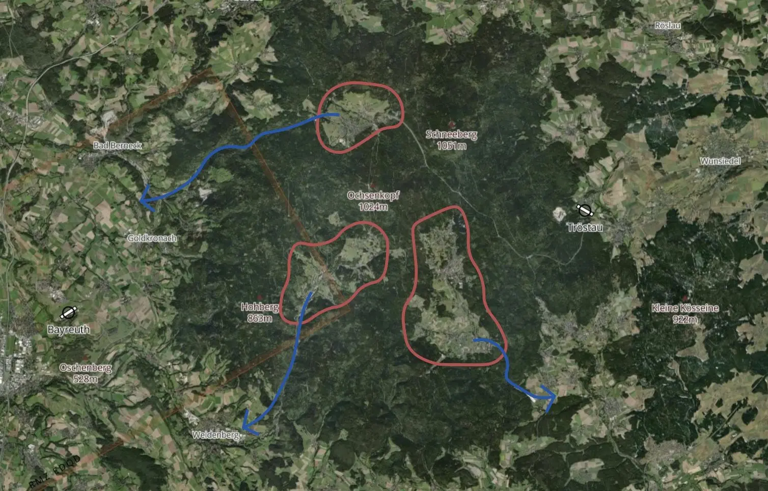
In the satellite image, you can see the Ochsenkopf and the Schneeberg behind it. Both are just over 1000m above sea level. The three plateaus, which are not forested, are clearly visible. They are also quite high at around 800 m and relatively open towards the valley. This has the great advantage that these three areas do not form a lake of cold air when they cool down at night, since the cold air mass can simply flow out downwards through the valleys. So when the sun shines at the Fichtelgebirge in the morning, it hardly takes any energy to release the first thermal developments from these plateaus. Depending on the wind direction, at least one of these three plateaus works.
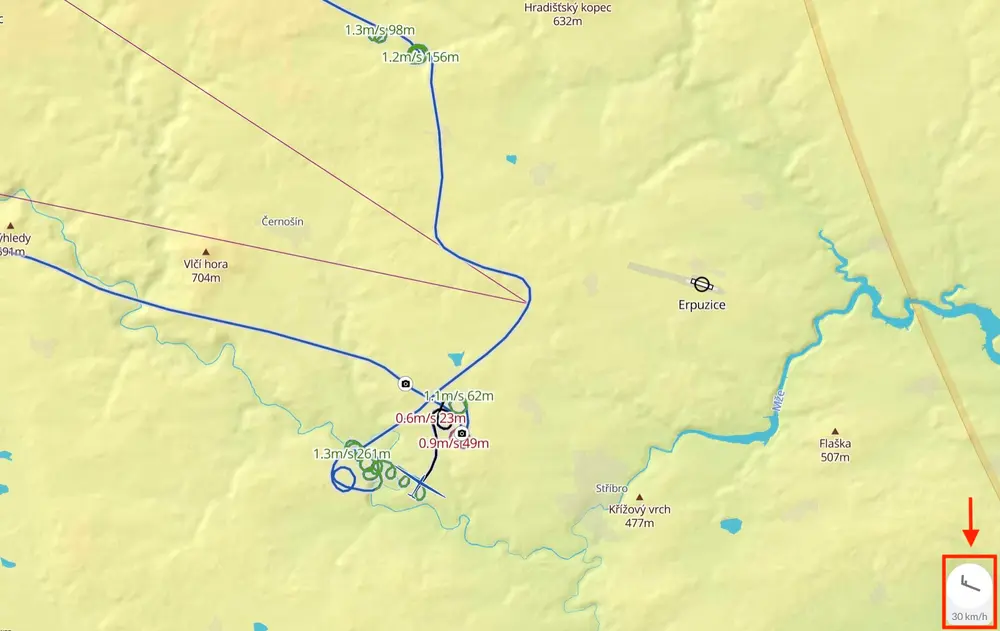
You climbed over 1000 meters at 07:10 UTC at 2.5 m/s and started your glide at 2300m.
Yes, that was actually relatively late and still gave no indication of how good the day was actually going to be. Unfortunately, it doesn't help if the Fichtelgebirge is doing well in the morning, but the rest doesn't follow in time.
The first pieces of fluffy clouds are always above this ring-shaped structure. Of course, the valleys down into the lowlands also have the advantage of the thermals that enough air can be "shoveled" to the plateaus.
Let's continue with the "Ochsenkopf-Ritual"...
On good gliding days, all of this takes place between 8 a.m. and 9:30 a.m. local time. But the crucial point comes in the hour that follows. Only then is it possible to better assess the quality of the day. If the first hour goes smoothly, it will usually be a good day if it doesn't over-develop in the afternoon.
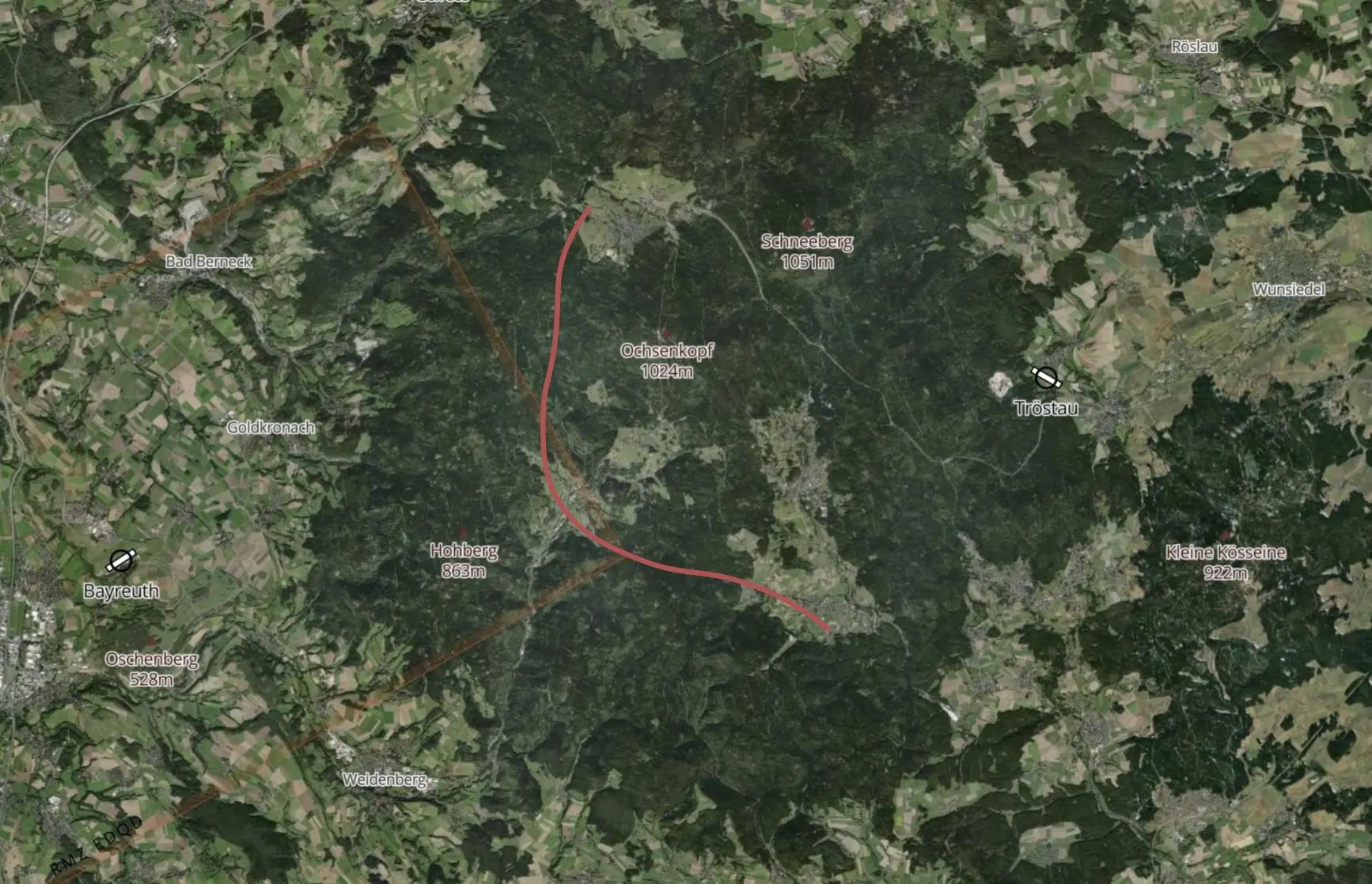
Also on July 5th, I am "sitting" on the Ochsenkopf and everything around is still sleeping. You can see the inversion from above and the first tricky decision of the flight day is pending. Which departure direction? Normally I decide based on the wind direction and also wait for the first cloud developments in the vicinity. However, I have to be very careful. The southeast take-off in the direction of Steinwald, for example, is treacherous. This also has a plateau but is a bit lower. I've often flown there too early and was invited to the first handicraft lesson somewhere near Erbendorf. However, thermalling low in the morning costs energy because the plane is still heavy and you have limited capacity on such a long flight day.
On this day, however, I flew northwest in the direction of the Thuringian Forest. But this decision also had its pitfalls! In the distance, I was able to observe the first, really nice developments after a short time. But many are familiar with this phenomenon: You can see clouds shooting out over the inversion in the far distance and estimate the distance completely wrong.
At that moment, I was naive to think that I could easily get there. So, at 9:30 am, I slowly set off. But after just a few kilometers I realized that I would never get to these beautiful clouds.
But I was lucky because exactly at that moment the first clouds formed in front of me, i.e. within range, which then quickly grew larger. I had my first "real" thermal at quarter to ten with 1.4 m/s. Of course, I take such a climb at this time and use it to the very top. From that point on I knew: "Here we go!"
And it looks like it was going well.
That's right, the development progressed rapidly from then on. The next sticking point is entering the system of the Thüringer Wald. Here I usually aim for the edge of the Sonnenberg. If you have 1500m-2000m MSL here, you are already well on your way and can make your way to the main ridge of the Thuringian Forest.
It seems as if you benefit from your enormous wealth of experience.
I guess so. For example, nowadays I always pass Suhl on the Northern side, in my experience, things are much better there. Close by Suhl I have gotten low so many times over the years. At some point, you just don't need that experience anymore!
Your first turn point seems to be the next exciting key moment. In Late Night Soaring you remarked: "The problem in the open class is the weather limits". Here, however, it looks as if you could have continued. even further. The satellite image doesn't look bad, the climb values improved and your hourly speed went up.
First of all, what I've been doing very intensively for a long time: I look very closely at every new satellite image during the flight and compare it with the appearance of my surroundings. I also run the animation to be able to assess the development.
The area around Kassel is known to me from experience as a weather limit. You can see this quite well in the satellite movie: With a little experience you can see some flat structures there, which have a tendency to move to the northeast compared to the developments in the south. In any case, I had the feeling that something was different there, that something was moving.
For a triangle, there were only two possible decisions for me: Further to the northeast or to the south. Usually, I don't fly north-west, directly into the Westhessische Senke.
I could see quite well to the north and northeast. However, the cloud base dropped there and the clouds were not as clearly defined as in my immediate vicinity.
From the forecasts, one could also infer that there would be a weather limit somewhere. These are the extremely important second decisions that you make. Surely one could have turned north. But it really wasn't my plan. With the weather forecast from the previous day and the current satellite film, I was betting that the conditions in the south will be stronger. So I turned there and headed south.
Did you have Klaus Wedekind's continental record from 1997 of over 1122 km in mind?
I always have that in my head because I would like to surpass this track.
I've flown the triangle once before, although at the time I "only" wanted to fly a large DMSt triangle and didn't have the record in mind at all. Unfortunately, the starting line in the DMSt is 2,000m wide, but only 1,000m for a record. So that day, for a registered record, I missed the departure line by 200 meters.
Incidentally, one of those moments that I will probably never forget. Back then, it was with 1,121.8km at least a continental record for the free triangle distance. But I was embarrassed!
Let's talk about the area around Würzburg. How did the decision to fly east of Stuttgart come about?
Even in the preliminary planning, it was clear to me that I didn't want to fly too far west. The decision was relatively easy to make using the forecast maps, as it should be blue there. The satellite movie also shows that the Kraichgau, in particular the area around Pforzheim, was not yet remarkably developed at the time. I didn't want to risk tinkering with the entrance to the Black Forest and losing valuable time. I then promptly had a tinkering hour after climbing up the Alb.
Let's come back to Würzburg. As a student pilot, I was always told to be careful in the area around Würzburg and Giebelstadt. According to the phase analysis, however, you had a real run there.
Normally this is actually an area that I don't fly to, at least until the afternoon. I usually fly further west in the Spessart and in the Odenwald. But on July 5th, west of Würzburg, there was just an unbelievable run. The thermals were strong and round, reliable as clockwork. It was so amazing for this area and I can hardly describe it. I definitely had a good run there and the hourly speed went up.
You weren't any slower than the gliders in the Steigerwald.
It looked great everywhere. It was here that I first felt the potential of the day. That was almost my undoing later on, as I briefly touched on before. In summary: The flight section was awesome, in an area where I would not have expected it. Along with Würzburg and Giebelstadt, Schwäbisch Hall is often not particularly exciting. Normally we fly up there more in the afternoon, towards the north of the Steigerwald. Steigerwald or not, that played a role at that point. The cumulants were right where I needed them. A real stroke of luck.
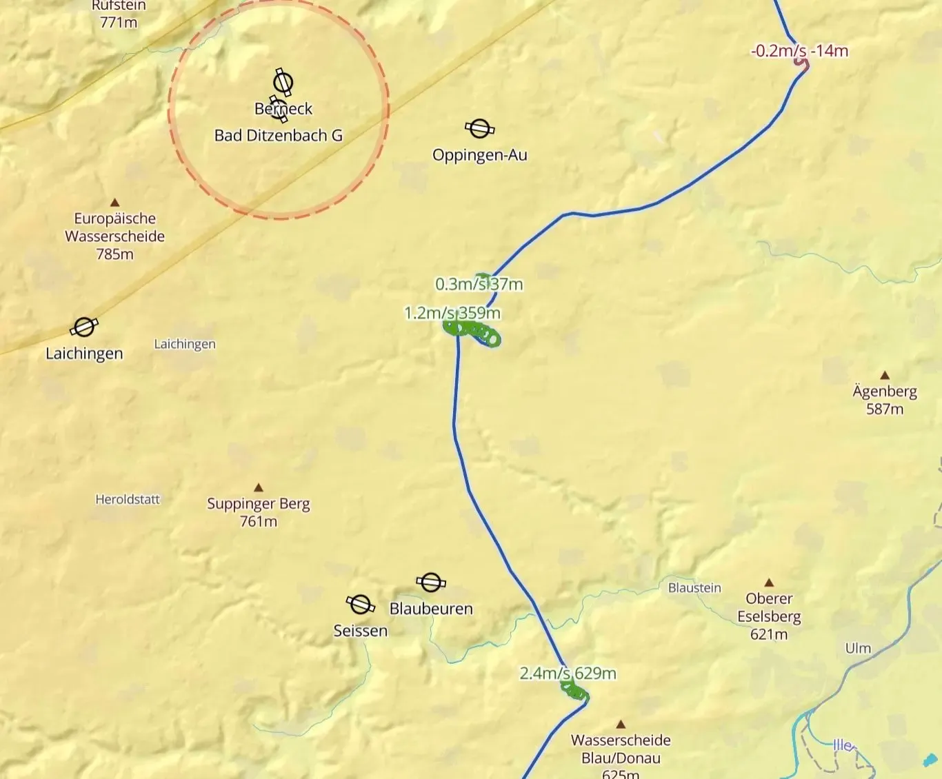
Afterward, we went to the Alb full of euphoria. In the Thermal Replay you can clearly see that the thermals were weaker there in comparison.
Yes, and that's where it almost got me. In the area around Oppingen, showers had obviously formed beforehand, although I could no longer see any shower clouds at the time of my arrival. These had already dissolved and fell to the ground as rain. The treacherous thing was that you could only see it against the sun if you looked very closely and from a certain distance. By the time I realized that the light veils in the sky were (still) falling rain, it was almost too late. Added to this was the euphoria that developed on my second leg. Correspondingly late, I switched mentally at this point.
How did you deal with the situation?
The rain had fallen on the Alb ridge and the air was no longer thermally active. I was just in the wrong place at the wrong time. So first I slowed down and continued carefully. Only at the Autobahn 8, south of Oppingen, did I find what I was looking for. There I had to start very carefully and low at 0.3 m/s in order to get more room to maneuver again.
It is well known that you have nerves of stale when it comes to flying close to the terrain. Do you think the low-safe affected you mentally, or did you let it go easily?
I'm often asked that. In my opinion, it's just part of the game. Over the years I have learned to deal with these situations in a focused and self-confident manner. Of course, it is important that you know both yourself and the aircraft well. In such a moment I really become one with the EB 29 and develop an extremely sensitive feeling for thermals that are just emerging close to the ground. By that I mean, even if it's just "bubbling" a little at first and the thermals aren't really developed yet, I can just keep in there with the large span and at least create options for myself again.
And that doesn't cost you any energy?
Well, if I've done it for an hour, it takes a lot of energy. I usually only notice afterward, when a relaxed phase comes again, that the strong concentration takes its toll. However, I don't throw away the day because of this or continue to fly particularly passively afterward.
How did the flight continue afterward?
About two kilometers south of me, two gliders also started circling. On my Flarm display, I climbed a little better at first, but then their climb quickly got better and of course, I quickly switched over to the other thermal.
In a moment like that, you are really grateful to your colleagues! With a solid altitude of 1000m AGL, I continued.
You had spotted a better option?
I had previously targeted a cloud to the south that was extremely interesting. The base had already risen significantly there, but about 300m below the cloud base additional condensation took place. This is always an indication that something is going on there. If I see something like that and my altitude allows it, I fly straight there. And it really got down to business and I was able to climb to 2,400m again!
Back at the cloud base, the decision had to be made, where to go next? In principle, the clouds south of the Alb ridge, towards the Danube valley, looked very tempting. The cumulus clouds were big and well-defined. So I first went to the southern edge of the Alb and then further to the southwest. As I was above Mengen, however, I felt that now would be a good time to turn.
According to the satellite image, you could have continued even further. Did you turn too early after your low save?
There might be something to it. If I get very low, I'm at least a little more careful afterward. I was spoiled by the good section from Würzburg. The low save near Oppingen brought me back down to earth, in the truest sense of the word. I wouldn't claim to fly more passively after such a low save, just more thoughtful and attentive again. However, it was definitely the case that the air mass here was different from the one I came from.
Did the conditions get worse?
I wouldn't say so. The clouds were partly frayed again and no longer so clearly structured. Further north I was able to get an idea of the potential of the thermals that day. They no longer had this quality in the area of Mengen and the feeling started as soon as I jumped onto the Alb. As already mentioned, I had to adapt my flying style to the new conditions. It's no different for me than for everyone else: You're flying, you're in the flow and suddenly you wake up!
In the vicinity of Mengen, it was not the case that nothing was going on, but the clouds were becoming quite powerful in the satellite image and I was simply drawn back to the better weather.
In hindsight, was that a good decision?
Difficult to say. I heard pilots from the Feuerstein on the radio who were traveling further west on the Alb and they weren't very enthusiastic. But it would definitely have been flyable. Of course, at the time of the second turn, I didn't know that it would close in the evening in the Bavarian Forest or stay there. In retrospect, it would probably have been better to extend it at least to the level of the cliff corner in order to extend the FAI share even further.
You said you always let the satellite film run along. Weren't you able to see the problems in the Bayerwald at the time of the second turning point?
Yes, you could see that. You can already see the flat structures of the overdevelopment there. According to the forecast, this was also announced at this time. However, the tendency to spread and over-develop should subside in the afternoon. Well, that's part of the game again. So the principle of hope applied to the third leg. In the satellite film, you could see that the spread was slowly decreasing, but I already suspected that the Bavarian Forest would probably no longer be practicably flyable.
How did that leg and the subsequent turning point in the East go?
At first, things went much better, similar to the region around Würzburg. This is often the case on this part of the route. The plan was then to go behind Regensburg to the edge of the Danube, which usually remains free of overdevelopment. North of my route it was still relatively dense at this point.
I then flew along the edge, but could quickly see that the base was sinking further to the east. The satellite image was also no longer particularly promising and the decision to turn around was once again shaped by weighing up opportunities and risks. In this position, I already had an FAI share of 980 km. In my opinion, that was enough points for the triangle course. So it didn't seem worthwhile to extend further to the southeast to get perhaps 100km more FAI distance but risk getting low which could have cost the whole flight. So off towards the Upper Palatinate!
During a big flight in 2020, you commented: "If the Upper Palatinate hadn't spreaded out again, it could have been a really big flight. So does it happen there more often?
No, the Upper Palatinate is rarely critical late at night. On the contrary, it usually goes very well. The problem with the flight in 2020 was that it was workin too well again, overdeveloped and spread out. At that time it was becoming increasingly difficult to find the thermals, the clouds were huge, the distances between the thermals were large and the next thermal was always too low for this time of day. The old rule applies: You should stay as high as you can after 5 p.m.!
Even if I don't shy away from flying low during the day, I try to strictly adhere to this 5 p.m. rule, otherwise, you simply risk the whole flight. That day even went a little better than on July 5th, unfortunately, the Upper Palatinate spread out in the evening. Otherwise, it would have been a day for more than 1400km, hence my comment.
This time things went quite well there, but shortly after Bayreuth you had the second low point of the day.
Yes, that was very interesting. Since we just got it from the Oberpfalz. In this situation, I always try to save myself in the direction of Bayreuth. There, or at the Fichtelgebirge, is usually the saving thermal. This time it was different. The Upper Palatinate was doing well, but just before Bayreuth, it wasn't working at all anymore. You can see how I literally crashed between Grafenwoehr and Bayreuth.
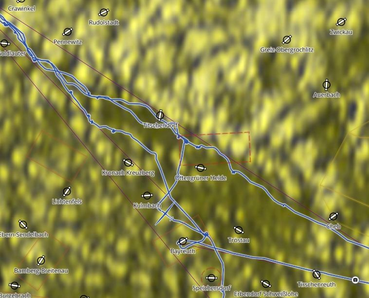
As usual, I flew the classic route to Bayreuth. The most beautiful clouds were still in front of me, but they didn't bring me any climbs. At that moment I got a saving tip from a club colleague that there was a convergence north of Hof. Hence the spike in the flight path.
It can also be seen quite well in the satellite image, maybe it had sucked off your surroundings?
Possible, or at least weakened the thermal quality at this point. Anyway, I thought to myself: "This is the key to how to proceed. You still have enough altitude". So I took a sharp turn north and easily reached this convergence even with a short thermal.
Then came the best thermal of the day, definitely a good decision!
Yep, that was like riding a rocket. On the clocks sometimes with more than 6 m/s. It definitely justified the detour!
Afterward, conditions really went off. According to the phase analysis, you didn't have to thermal for more than 140km.
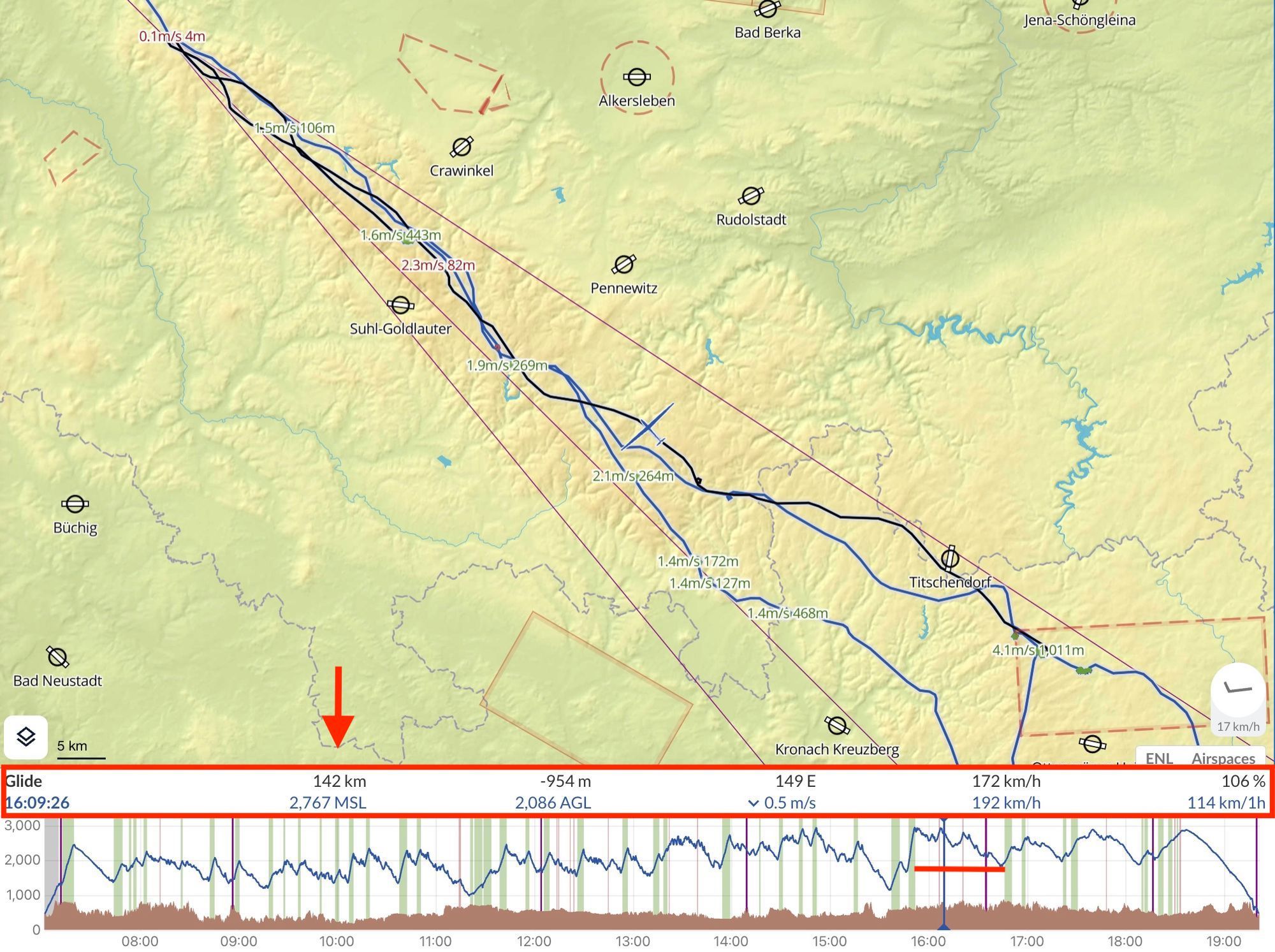
In principle, that was our famous "Thuringian Bratwurst", which this time was shifted to the north. It was clear to me that I had to consistently fly it out as long as possible. Most of the time it's the Great Inselsberg is over. Shortly before Ruhla I turned around and took what came with me again. Luckily I had two legs left that day, unfortunately, that was not the case on my flight in 2020.
At the latest then did the calculations start?
Well, actually it runs parallel all day long! At this point, however, it was already clear to me that I would have to extend farther east to complete the 1400km. At first, I was just trying to follow the convergence as closely as possible. Then came the second big stroke of luck of the day. In the Czech Republic, there is a new TRA from FL75, for which glider pilots usually do not get clearance. On the way back to the Southeast, I was hoping that Convergence wasn't going there. That would have made the 1,400km impossible.
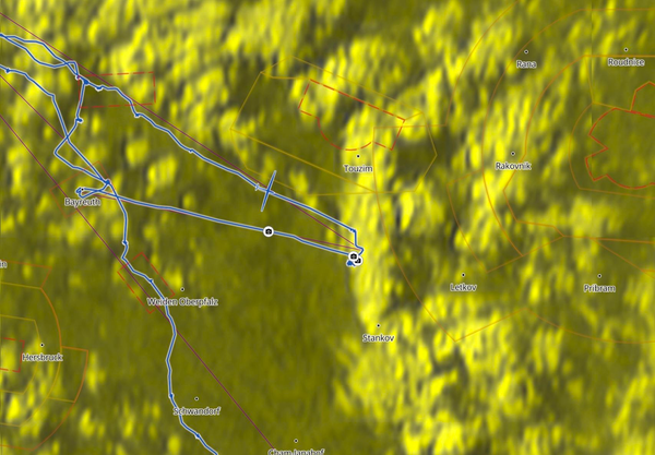
However, as can be seen in the satellite image, the cloud structure is bent to the south, exactly at the border of this airspace. That was the rescue. I flew past Cheb and was then able to follow the clouds a little further south. Of course, I already thought about how to proceed now. The original idea was to keep following the cloud road, but after 11 hours of flight time, as is well known, you don't make particularly smart decisions anymore. So it was really high time to turn it off so as not to get into conflict with the length of the day. At this point, I had calculated 1,420 km on Bayreuth, but I wasn't on the glide path yet.
To top it all off, the wind picked up in the evening, as can be seen in the phase analysis.
Yes, it had picked up at this time. At first, I had to accept weaker climbs. However, due to the wind shift, the glide path just didn't get any better.
So I had to concentrate one last time and after some centering, I finally managed to climb better. With +600 I flew to Bayreuth.
Then the well-deserved final approach to the 1,400 km?
I'm used to that from Namibia. Nice long final glides. Then you lean back and just enjoy the day again!
A piece of gliding history that you wrote there.
Time will tell. Over the years you get a feel for where the limits are. I once discussed with Michael Sommer what is possible in gliding in Germany. At the time, I thought that 1,500 km of free track in Namibia was really tough. In the meantime, I'm ready to say that 1,500km is also possible in Germany if everything fits together.
What has to fit?
Experience and luck as I had on July 5th. There are a lot of unknowns in our sport, above all the weather. On the one hand, that makes it extremely exciting, of course, but also always difficult. You simply cannot reliably plan where the weather in Germany, in a specific place, at a specific time will be perfect. But that would be the prerequisite for such a route or you just have a good portion of luck. In Germany, I know some pilots who can fly 1,500 km. But for a flight like this, everything really has to fit!
Again: If a good pilot, from the right take-off site, in the best weather, with a top-class aircraft, who makes many right decisions during the flight, and has a bit of luck, it can be done.
But the emphasis is on making the right decisions. For example, there is no use flying in the wrong direction from the right starting point in the morning. I've often taken off with the wind in the morning because it's basically just smarter. But then I quickly came into conflict with the wetness of a retreating front and the day was gone. Back to the topic: I think the day will come when the 1500km will be cracked, but it may take a while.
Speaking of optimization. Did you consider flying up the Steigerwald again?
No, that wasn't the plan that day. I had planned a large triangle and consistently pursued the plan during the flight.
Now, hand on heart: Do you think 1,500km would have been possible with a yo-yo between the Thuringian and Bavarian Forests? According to the Feature Day Replay, everyone was super fast.
I haven't looked at that yet, but I think so. The exciting question here is: would it have been so valuable to me personally that day? This goes exactly in the direction that I described on the subject of DMSt. You still have to fly big triangles to get a solid base on the points. I did the same thing on July 5th.
In my opinion, large yo-yos are also a great achievement, because a 1,500 km thermal flight in a flat country, without slope wind and waves, shouldn't go wrong, just like a large DMSt triangle. It's just a general mindset problem.
Would you be happier about 1,500 km in Namibia or are the current 1,400 km in Germany the height of feelings?
Definitely in Germany, of course! One tends to compare everything on the gliding platforms. It is clear that the flights in the Argentine wave or in thermal Namibia will look more and more spectacular in terms of numbers, but the situation is completely different. In the end, the rating doesn't really matter to me. It is much more important to me how I felt about it personally and whether I had the feeling that I had surpassed my previous performances. The 1,400 km in Germany definitely surpass the 1,500 km in Namibia. But of course, I would still like to fly 1,500 km in both countries!
How do you get off the plane after such a long flight?
In the past, about 10-15 years ago, I could pull off such a number three days in a row. There were times when I sat on a plane for 36 hours over a long weekend. Now I'm 66 years old and I have to admit that I'm noticing my age. On July 5th. I could have added three more after the eleven hours and even after getting off I'm still reasonably fit. But already on the way home, I get tired and after dinner, I just fall dead into bed. The next day I would have to force myself to get back on the plane.
How is it in Namibia? You often fly there several days in a row there.
An interesting question! Of course, my physical condition depends on the quality of the flight. In Namibia, only the first two hours are often a bit stressful, as you are out in the blue with a low base. But as soon as the first clouds come, the actual game begins, and then it's just fun. Of course, you also have to make important tactical decisions in Namibia, but when you fly with high cuts under high base in the conditions there, the euphoria is unbelievable.
You're just happy up there, enjoying the landscape and enjoying the conditions that nature has given you. Personally, this euphoria helps me to stay fit and not to get tired. In Germany, with our weather, the mental battery is emptied much faster.
Long-haul flights are known to be your passion. Was there a point in time when you noticed a significant leap in performance?
Not directly. I would describe my development in cross-country soaring as an asymptotic learning curve. Knowledge and experience are constantly accumulating, but at some point, you approach your maximum, also in relation to your age. In principle, I always learned something new without a special, decisive moment. There were only leaps in performance due to better technology, such as the new aircraft or the live satellite images. In fact, I'm sure there were years when I regressed because I was too stressed out professionally or just didn't get enough to fly.
I think a lot about the developments in gliding, especially in the last 30 years. Technology is clearly the top priority for me. On the one hand, of course, the great aircraft that we have today, but also innovations such as GPS and the developments based on them. The online platforms, which have led to an unbelievable leap in performance due to their transparency, deserve special mention here. Suddenly everyone could understand where other people fly, how they fly there, and maybe why they make certain decisions. This transparency and exchange should not be underestimated. With our conversation, we both ensure that gliding continues to develop since everyone can have access to it.
Another point for me is the new forms of competition that have developed from this because I would like to claim that the DMSt was not really designed to keep exploring the limits of gliding. At least if you intend to be at the top of the rating lists.
Then we start again a short excursion to the DMSt?
That makes me happy. After all, there are still generations after us and we don't just want to leave them great distances, but also visions for gliding.
The DMSt dates back to a time when the weather conditions were even larger than the possible distances. At that time, both the airplanes and especially the pilots were still flying in other dimensions, since the weather forecasts were not that reliable either. Today it is definitely different and you often come into areas that exceed weather limits. I often had the situation where I tried to achieve turns, although it made no sense to continue flying in this direction. If the turn went wrong, not only was the DMSt classification for that day lost, but also the free classification, because you either landed on the outside, pulled the engine, or was simply too slow.
Personally, I always want to explore what is actually possible in a day in the air, not what I predicted before the flight. This also includes deciding when it is simply over in a certain flight direction!
Over the years, pilots have figured out which routes work well for DMSt flights and which don't. Standard routes have been developed that ensure a good finish in this rating, keyword: oil track. In principle, it is then a question of whether or not the right weather comes for these routes in the respective season and whether one's personal time allows one to use this weather.
However, by experimenting and taking risks, you may worsen the result of a flight in terms of points.
Example: If, for example, in the evening I fly 100 km beyond the previously defined, last turn and then have to pull the engine shortly before going home, the flight is worth a lot to me personally because I tried to push my limits further. But in the DMSt you fall behind. As a result, the routes are flown smaller than they could actually be. At least you don't increase these standard distances unnecessarily, because in case of doubt you decide on the higher score and not for the higher risk. That's why I'm more of a friend of free routes. There are often flights on the internet where I think to myself: "It's crazy, I've never thought of where it flew to before". The achieved DMSt points take a back seat to me!
What would you readjust at the DMSt if you could?
Well, let's take the German Gliding League as an example. With my index, I didn't have a chance to seriously get involved there for a long time. The high index of the EB 29 is justified and I claim to be able to fly it. But not in the early afternoon, in the best 2.5 hours of the day, but in the morning and evening. It's difficult to keep up on points against a good standard-class aircraft in the Bundesliga. After the reduction factor was introduced for the Bundesliga, the performance comparison was a bit fairer again and that of course motivates.
I would personally tweak the geometry at the DMSt. For me, the geometrically highest discipline in cross-country flying is not the triangle, but out & return flights. You move in the largest weather space, which makes meteorological planning challenging. In addition, you don't have an exit strategy, like with the triangle, where you can break off at the start of the leg before the last turn and start your way home if you don't have enough time. As soon as you turn around at the finish line at the turn, you're flying against the clock, which I find extremely exciting.
But to the DMSt triangle: You could, for example, reduce the bonus points of the "completed" triangle a little. Using the example from before, if I fly 100km out of the turn and then back again, I might still win enough points even if I can't complete the flight in the evening due to missing a few kilometers.
A good point. How do you deal with it when you don't have a clear head while flying? do you start at all?
Since I no longer have to work, this problem is fortunately limited. But of course, I know that from before. Things were constantly going through my head during the flight, so I never landed. Today I notice very clearly that I have more freedom in my head and fly more relaxed accordingly.
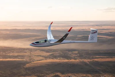
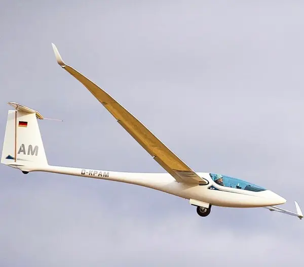
A few more words about your plane. The appropriate designation was found in the comment column: EB 29 LR (Long Range). Why are you staying true to your "old" EB?
There are several reasons for this. On the one hand, as everyone knows, I am first and foremost a self-confessed long-distance pilot. However, the EB 29 "R" was clearly optimized for competitions and, since the weight there is limited to 850kg, is the best competition aircraft in the world.
In Namibia, I've been on the road a lot with EB 29R pilots in a team in recent years. My observation: As long as we are flying with identical wing loadings, there are no differences in performance and I can easily keep up with the "R". The R wing has a higher aspect ratio and climbs better with the same wing loading, but this is hardly relevant in the strong conditions in Namibia since everyone uses the maximum permissible weight of their aircraft anyway and that is around 50kg with my edition version higher than the "R".
When it comes to core competition, the "R"'s higher wing loading at 850kg allows the aircraft to fly in a higher speed range without suffering much penalty in climb. Thanks to its new profile, the EB 29 R is also better in terms of thermal sensitivity and agility.
When I've flown with "R" pilots, it was often the case that they turned their plane 45° or more into the supposed thermal, then straightened it up again and continued flying if the thermal wasn't strong enough. It's not that easy with my EB. Inside is inside! And usually I have to fly the circle to the end.
Conclusion: The EB 29R combines better handling with a higher wing loading than the competition! However, for me it has the disadvantage that I cannot vary the span. With my EB 29 I fly the short span (25m) in the mountains, the medium span (28m) in Namibia and the large span (29m) at home. For me the best!
On average, do you think you fly more detours than other Open Class pilots?
I don't know, but here too you have to differentiate between long-distance flying and competition. The second is more compact in terms of time and space, so the tactics must be designed accordingly. Detours, climb values and pre-flight speed must be optimized, because every second and every km of speed is important. With long-distance flying, everything is a little more spacious. General, far-reaching decisions have to be made here and the route planning has to be adjusted accordingly. Precisely because you are flying flat, it is very important to be in the right place at the right time, since the weather is seldom homogeneous.
Let's take the example of a 400-meter runner who needs to pace himself differently than a marathon runner. It's no different with gliding. In competition, you also classify your physical condition differently than when you sit in the cockpit for 11-12 hours. I would say that I tend to take detours here in order to avoid exhausting situations and risks. If I am given a convergence over 300 km in Namibia, I will of course fly it without any major detours. Unfortunately, something like this rarely happens at home, but there are many airspaces that you have to fly around.
It seems you have good staying power. Do you have certain routines during your long flights to stay focused?
To be honest, not really. I try to concentrate on the flying optimum all the time. If I don't manage to do that, I get the receipt after 15-20 minutes and I'm low. Therefore, my focus is on flying the aircraft in an energy-saving manner and possibly on means that help me to make smart, tactical decisions.
I've given up the habit of radioing a lot and the radio is therefore mostly set to low. I also never take photos or write WhatsApp messages because it just distracts me too much. The photos from the 1,400 km flight were therefore the absolute exception.
What would make you stop gliding?
I had a good friend who gave up gliding a long time ago. He always had time, was in the air in every imaginable weather condition and was therefore a good pilot. But at some point he lost the fun of flying; he got bored. I too have days when I realize that I don't like flying. I usually turn around and often end up at noon.
You have to keep the fun of flying, whatever it looks like. It's incredibly important and if I really shouldn't have it anymore, I'll stop!
A long conversation after a very long flight. Alex, thank you for the detailed words!
The work of our authors is also made possible by the many people who care about WeGlide and who support us with a subscription.
 Joshua Rieger